
Sunshine takes over today and for the foreseeable future as temperatures will soar into the weekend bringing dangerous heat.
Friday morning is off to a quiet start with brisk temperatures. Some spots have dropped into the upper 40's!
Today's weather stays comfortable as we reach for the upper 70's. Sunshine will dominate with a few clouds joining us into the afternoon. Conditions remain dry as there are little to no chances for rain for the several days.
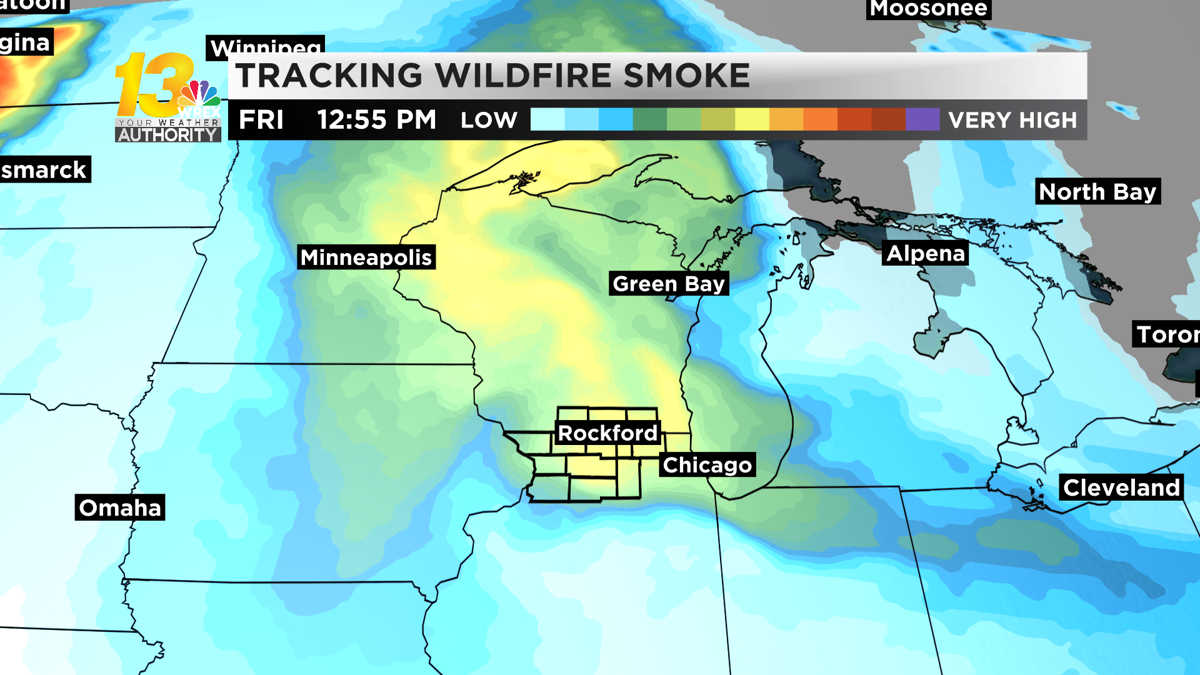
Along with the comfortable weather, you may also notice hazy skies. Some wildfire smoke will move during the afternoon and may impact our air quality. There is an Air Quality Alert in effect for southern Wisconsin through Monday. Friday's air quality may drop to unhealthy levels for those in sensitive groups.
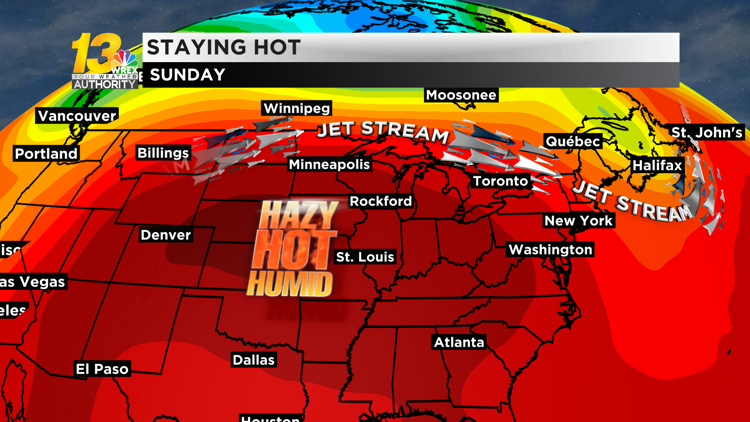
With the smoke moving out into Saturday, the heat starts to build in. The mid to upper 80's are on the menu for tomorrow with the 90's taking over by Sunday. A large ridge bringing in heat and humidity parks itself over much of the Midwest starting this weekend looks to stay through much of next week.
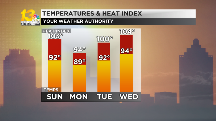
Temperatures will remain in the 90's from Sunday through Thursday with the exception of Monday. Some cloud cover will move in keeping temperatures into the upper 80's. Heat index values will likely be in the triple digits for several days.

Carroll and Whiteside counties will see an Excessive Heat Advisory go into effect on Sunday through Monday evening. Dangerously hot temperatures are expected bringing out heat index values into the triple digits.
It will feel like we're in the triple digits through most of next week as the 90's really settle in. It's not until the next weekend do we see some relief from the heat and dry weather.
Keep the heat top of mind if you have any outdoor activities this weekend or if you work outside. Drink lots of water and take frequent breaks.


